Upper Lake Clementine rocks
UnverifiedIntermediate (31-60 ft)38.96250, -120.97900
Confirmed by 0 jumpers
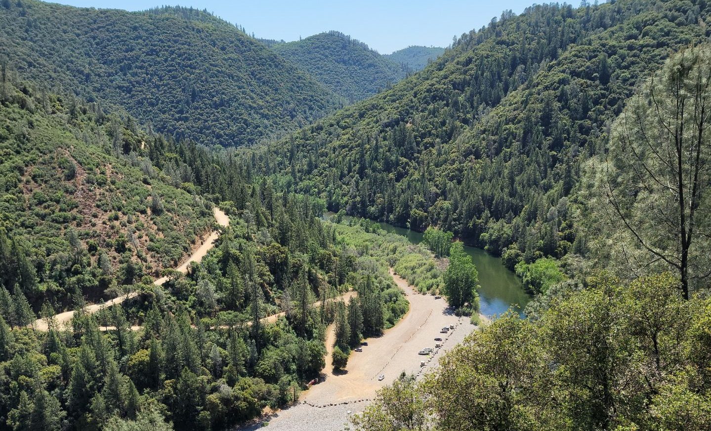
The upper end of Lake Clementine, where the North Fork of the American backs up behind the dam into a green, walled canyon forty minutes from Sacramento. People jump from the rocks across the water from the main beach — short drops rather than big air, in a canyon that feels a long way from the freeway.
Jumps at this location
Rocks across from the beach
Height not listed
Intermediate (31-60 ft)
Warnings
Depth here changes with the lake level and there are submerged rocks you cannot see from above — check your landing from the water, every visit. This canyon kills people most summers: the current above the lake is stronger than it looks and the water is snowmelt cold. Several of the deaths have been strong swimmers caught out by the cold, not jumpers.
Access
Auburn State Recreation Area; the upper lake is reached from Upper Lake Clementine Road off Foresthill Road, with a walk down to the beach. Day-use fee, gates close at dusk and the lot fills early on summer weekends. Only non-motorised craft are allowed on this stretch. The pin marks the upper-lake beach area.
Best conditions
July through September, after the spring push has gone out of the North Fork.